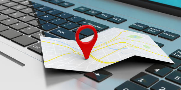
Bachelor of Science in Geographical Information Systems (GIS) and Remote Sensing is a specialized program that focuses on the collection, analysis, and interpretation of spatial data to solve complex geographical problems. It integrates principles from geography, computer science, and earth sciences to understand spatial patterns and processes. In Tanzania, where geographical information is crucial for sustainable development, this program aims to equip students with the skills needed to apply GIS and remote sensing technologies in various sectors.
Jobs for Bachelor of Science in Geographical Information Systems and Remote Sensing
1. GIS Analyst: GIS analysts collect, manage, and analyze spatial data to create maps and support decision-making in various fields such as urban planning, environmental management, and disaster response.
2. Remote Sensing Specialist: Remote sensing specialists use satellite and aerial imagery to monitor land use changes, assess environmental conditions, and conduct natural resource inventory.
3. Cartographer: Cartographers design and produce maps that communicate spatial information effectively, using GIS software and other mapping tools.
4. Spatial Data Scientist: Spatial data scientists analyze complex spatial datasets to identify patterns, trends, and relationships, using statistical and machine learning techniques.
5. Urban Planner: Urban planners use GIS and remote sensing data to analyze urban growth, assess infrastructure needs, and develop sustainable land use plans.
6. Environmental Consultant: Environmental consultants assess environmental impacts, conduct spatial analysis of ecological resources, and develop mitigation strategies for environmental management projects.
7. Geospatial Engineer: Geospatial engineers design and develop GIS applications, databases, and tools to support data collection, analysis, and visualization.
8. Land Surveyor: Land surveyors use GIS and remote sensing technologies to collect and analyze geospatial data for property boundary delineation, construction planning, and land management.
9. Geospatial Analyst: Geospatial analysts process and interpret satellite imagery, LiDAR data, and other geospatial datasets to support a wide range of applications such as agriculture, forestry, and natural resource management.
10. GIS Project Manager: GIS project managers oversee the planning, implementation, and evaluation of GIS projects, ensuring that they meet client requirements and project objectives.
11. Transportation Planner: Transportation planners use GIS tools to analyze traffic patterns, optimize transportation networks, and plan for infrastructure improvements.
12. Emergency Management Specialist: Emergency management specialists use GIS and remote sensing data to assess risks, plan for disaster response, and coordinate emergency operations during natural disasters and humanitarian crises.
13. Water Resource Manager: Water resource managers use GIS to analyze hydrological data, model water flow, and manage water resources for irrigation, drinking water supply, and watershed management.
14. Natural Resource Manager: Natural resource managers use GIS and remote sensing data to monitor and manage forests, wetlands, wildlife habitats, and other natural resources.
15. Geospatial Data Administrator: Geospatial data administrators manage geospatial databases, metadata, and data sharing platforms to ensure data quality, accessibility, and security.
16. GIS Educator: GIS educators teach GIS and remote sensing courses at universities, colleges, and training institutions, preparing students for careers in geospatial technology.
17. GIS Technician: GIS technicians assist GIS analysts and specialists in data collection, processing, and analysis tasks, providing technical support for GIS projects and applications.
18. Real Estate Analyst: Real estate analysts use GIS data to analyze property values, market trends, and location suitability for real estate development and investment.
19. Health GIS Specialist: Health GIS specialists use GIS and remote sensing data to analyze spatial patterns of disease, assess healthcare access, and support public health interventions.
20. GIS Software Developer: GIS software developers design, develop, and maintain GIS software applications, custom tools, and plugins for specific GIS functionalities and industries.
Challenges of BSc in Geographical Information Systems and Remote Sensing
In Tanzania and worldwide, challenges facing graduates in this field include:
1. Data Quality and Availability: Limited availability of high-quality geospatial data and challenges in data acquisition, processing, and integration.
2. Technical Skills Gap: Shortage of skilled professionals with advanced GIS and remote sensing skills, particularly in emerging technologies and specialized applications.
3. Infrastructure and Technology: Inadequate infrastructure and technology constraints, such as limited access to high-speed internet, computing resources, and software tools.
4. Interdisciplinary Collaboration: Challenges in interdisciplinary collaboration and communication between GIS professionals and domain experts in various sectors.
5. Ethical and Legal Issues: Ethical considerations related to privacy, data ownership, and intellectual property rights in the collection, use, and dissemination of geospatial data.
How a Graduate from this Course Can be Self-Employed
Graduates can explore self-employment opportunities through:
1. GIS Consulting Services: Providing GIS consulting services to government agencies, private companies, NGOs, and research institutions. This may include GIS project management, data analysis, and custom application development.
2. Remote Sensing Analysis: Offering remote sensing analysis services for environmental monitoring, land use planning, and natural resource management projects.
3. Custom Mapping Services: Developing and selling custom maps and spatial data products for specific applications such as tourism, real estate, and urban planning.
4. GIS Training and Education: Providing GIS training courses, workshops, and online tutorials for individuals and organizations seeking to build GIS skills and capacity.
5. Spatial Data Analysis: Conducting spatial data analysis and modeling services for clients in various sectors such as agriculture, forestry, hydrology, and public health.
Advantages and Disadvantages of this Course
Advantages:
1. High Demand: Graduates of GIS and remote sensing programs are in high demand across various sectors, including government, industry, research, and academia.
2. Versatility: GIS and remote sensing skills are transferable across different fields and industries, providing graduates with diverse career opportunities.
3. Technological Advancements: Rapid advancements in GIS and remote sensing technologies, such as satellite imagery, LiDAR, and unmanned aerial vehicles (UAVs), offer new opportunities for innovation and application.
Disadvantages:
1. Technical Complexity: GIS and remote sensing can be technically complex fields, requiring proficiency in software tools, data processing techniques, and spatial analysis methods.
2. Continuous Learning: Keeping up-to-date with advancements in GIS technology, software updates, and emerging trends requires ongoing learning and professional development.
3. Data Limitations: Challenges related to data quality, availability, and compatibility can pose barriers to effective GIS and remote sensing applications.
Recommendations concerning BSc in Geographical Information Systems and Remote Sensing
To enhance the Bachelor of Science in Geographical Information Systems and Remote Sensing program:
1. Practical Training: Provide hands-on training and practical experience in GIS and remote sensing applications through internships, fieldwork, and laboratory exercises.
2. Interdisciplinary Curriculum: Develop an interdisciplinary curriculum that integrates GIS and remote sensing with other relevant fields such as geography, environmental science, computer science, and statistics.
3. Industry Partnerships: Foster partnerships with industry stakeholders, government agencies, and research institutions to align the curriculum with current industry needs and trends.
4. Professional Certification: Offer opportunities for students to pursue professional certifications in GIS and remote sensing, such as Esri's ArcGIS certifications, to enhance their credentials and employability.
5. Research Opportunities: Provide opportunities for students to engage in research projects and applied studies in GIS and remote sensing, allowing them to contribute to advancing knowledge and addressing real-world challenges.
Conclusion
A Bachelor of Science in Geographical Information Systems and Remote Sensing plays a crucial role in addressing spatial challenges and supporting sustainable development in Tanzania and worldwide. Despite facing challenges such as data limitations and technical complexity, graduates have diverse career opportunities and avenues for self-employment in GIS consulting, remote sensing analysis, custom mapping services, training, and spatial data analysis. By addressing these challenges and implementing recommendations, Tanzania can cultivate a skilled workforce equipped to harness the power of GIS and remote sensing for informed decision-making, resource management, and environmental stewardship.


.jpg)


.jpg)
